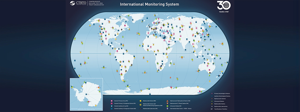
International Monitoring System Map
The International Monitoring System (IMS) spans the globe with a unique network that, when complete, will consist of 321 monitoring stations and 16 laboratories hosted by 89 countries around the world.
Around 90 percent of these 337 facilities are already up and running, providing a steady flow of real-time data. The system has already proved its effectiveness, detecting all six of North Korea’s declared nuclear tests as well as a steady stream of phenomena from earthquakes and volcanic eruptions to whale song.
The IMS is made up of the following types of facility, using state-of-the-art technology:
- Fifty primary and 120 auxiliary seismic stations to monitor for an underground test by measuring shockwaves through the ground.
- Eleven hydroacoustic stations to detect soundwaves through the ocean from an underwater explosion.
- Sixty infrasound stations to listen for ultra-low-frequency sound waves moving through the atmosphere at levels inaudible to the human ear.
- Eighty radionuclide stations to detect radioactive particles or gases from atmospheric explosions, or vented by underground or underwater nuclear explosions.
- Sixteen radionuclide laboratories to assist radionuclide stations in identifying radioactive substances.
The locations of these facilities, which include some of the world’s most remote and inhospitable environments, were designated in the Comprehensive Nuclear-Test-Ban Treaty (CTBT) in 1996. In some cases the CTBTO Preparatory Commission has since approved adjustments to the original coordinates.
Click on the map to the right for a PDF showing full details of all IMS facilities by type and current location, as approved by the Preparatory Commission as of May 2026.
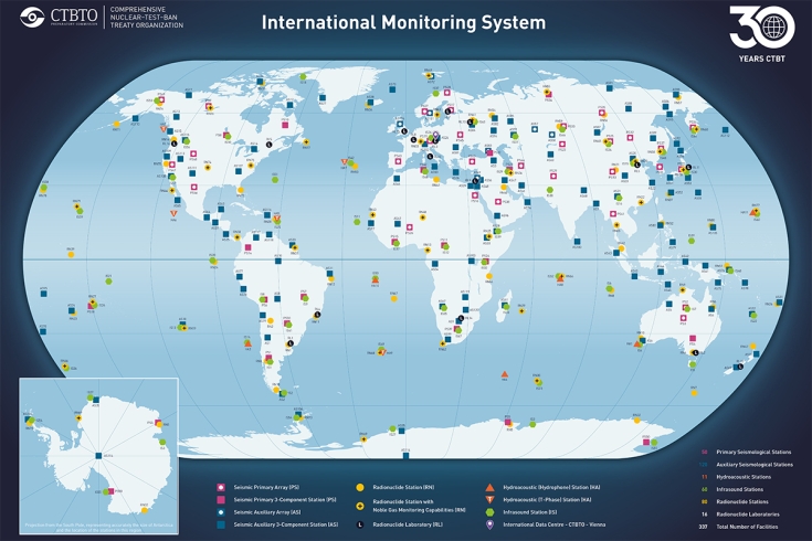
Click the map above to view a PDF outlining the monitoring facilities by type and location.