IS18, Qaanaaq, Greenland, Denmark
Thumbnail Profile: Greenland
Greenland, the world’s largest island, lies between the Arctic Ocean and the North Atlantic Ocean, northeast of Canada and northwest of Iceland. Devoid of land boundaries, it boasts over 44,000 km of coastline. Greenland possesses the world's second largest ice sheet.
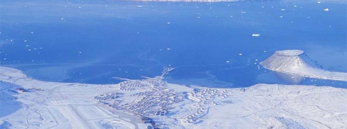
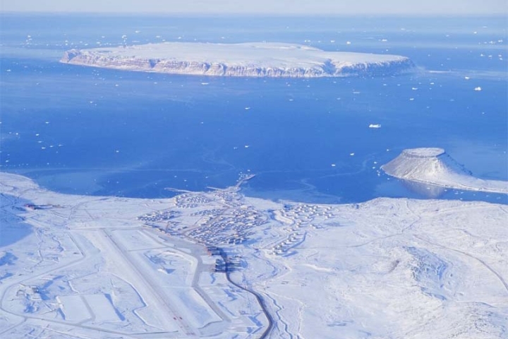
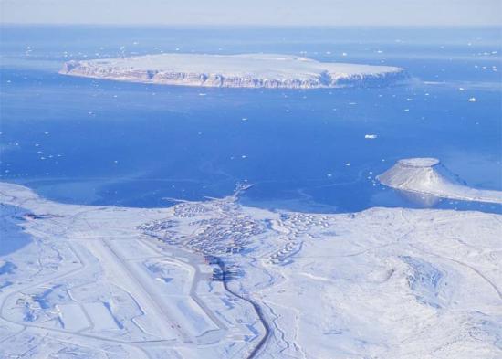
The tiny town of Qaanaaq is about 1,100 km north of the Arctic Circle and is Greenland’s northernmost permanent settlement. Rather uniquely, it counts more huskies than people amongst its resident population. With a population of 640 and a dentist who makes the trip to this town only twice a year, Qaanaaq is also the world’s most northerly palindrome—that is, in this case, a town with a name that reads the same backwards or forwards. Still, that distinction makes it no more geographically accessible! In the middle of nowhere and hours from the next settlement, Qaanaaq can be reached only by helicopter.
The terrain is a mostly flat but gradually sloping icecap that covers all land except for a narrow, mountainous, barren, rocky coast.
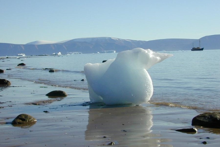
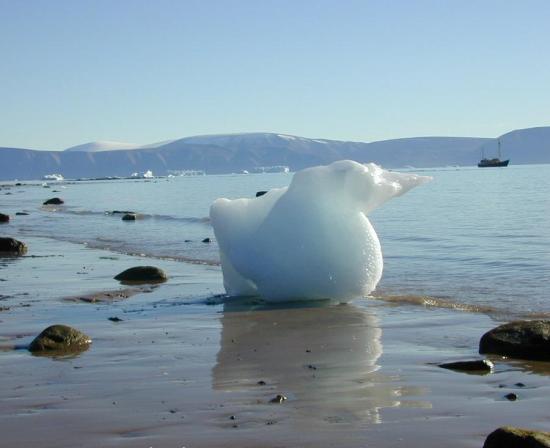
Flying north from Thule Air Base at Northmountain, one can witness a rare view of the breathtaking icy and rocky northern coast of Greenland. Also visible from the sky is the vast expanse of the barren Arctic tundra, revealing a magnificent world of icebergs, fiords, and an ice cap that extends eastward to the horizon.
Climate, Topography and Local Customs
Greenland is not green. Rather, its climate is characterized as arctic to subarctic with cool summers and cold winters. The terrain is a mostly flat but gradually sloping icecap that covers all land except for a narrow, mountainous, barren, rocky coast. The lowest point is at sea level while the highest is Gunnbjørn (3,700 m).
Greenland is not that green.
Although northern Greenland sunsets tend to linger on for hours, there are brief periods during spring and fall when the difference between night and day is conspicuous. During the winter, the sun disappears out of sight below the horizon for about four months. Still, the brilliant “starshine” and the reflection of moonlight off the snow and ice allows outdoor work to continue in this surreal light.
Local inhabitants can be found hunting narwhale and seals throughout the open water season using traditional methods, including kayaks and harpoons. Appealing to Qaanaaq hunters, the narwhale provides not only meat for the hunter but also whale skins which are rich in vitamins. Polar bears are also hunted during the wintertime.

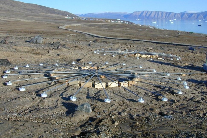
The IMS infrasound network locates and differentiates between atmospheric explosions, natural phenomena and man-made phenomena.
Station Location
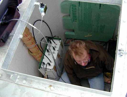
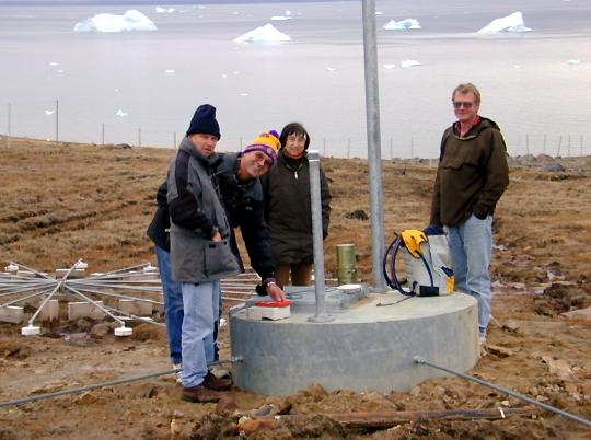
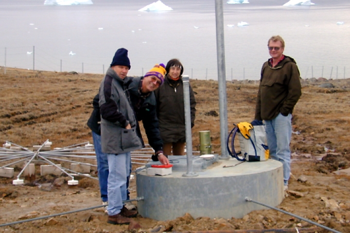
Situated between the town of Qaanaaq and the local airport, IS18 is maintained by the Danish Meteorological Institute (DMI).
Station Profile
Learn more about how infrasound technology works.
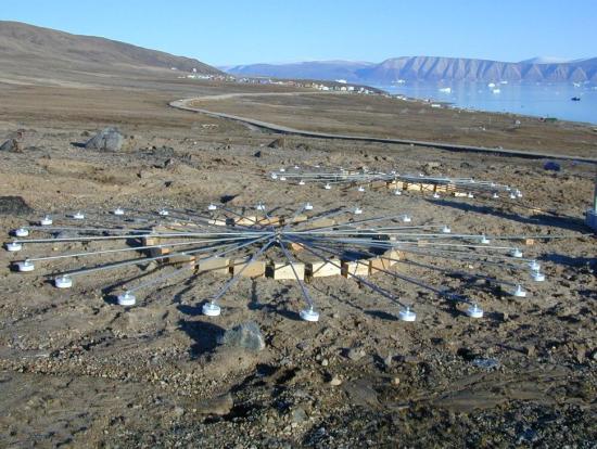
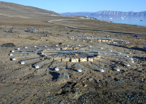
All IS18 array elements are located, like the village of Qaanaaq, close to the coastline.
Testing, Evaluation and Certification
Denmark is also host to another IMS station, auxiliary seismic station AS27 in Sondre Stromfjord, Greenland, some 1,500 km south of IS18.