
The CTBTO at the European Geophysical Union General Assembly
From 17 to 22 April 2016, around 11,500 geoscientists from around the world are congregating at the European Geophysical Union (EGU) General Assembly in Vienna, Austria. Scientists from the Comprehensive Nuclear-Test-Ban Treaty Organization (CTBTO) and Comprehensive Nuclear-Test-Ban Treaty (CTBT) National Data Centres are actively taking part. CTBT verification relies heavily on geophysical disciplines such as seismology, infrasound monitoring, and hydroacoustics.
A session on "Research and Development in Nuclear Explosion Monitoring" was convened on 21 April. This is the tenth year in which this session took place. There were six oral presentations and 23 posters covering a broad range of topics including global seismic event monitoring, on-site inspections as well as observation and tracking of atmospheric radioactivity.

Well-attended EGU session on "Research and Development in Nuclear Explosion Monitoring"
A press conference on the same day focussed on the technical findings regarding the announced nuclear test by the Democratic People’s Republic (DPRK) of Korea on 6 January 2016. Participants in the press conference were Martin Kalinowski, head of the CTBTO’s Scientific Methods Unit, as well as Nicolai Gestermann and J. Ole Ross, both from German National Data Centre (NDC), hosted by the Federal Institute for Geosciences and Natural Resources, in Hannover.
Kalinowski explained that using relative seismic travel time residuals (noted by colour scale) at four regional primary IMS array stations, the latest DPRK announced nuclear test could be determined to have taken place at around 750 metres distance from the previous test in 2013.
Gestermann briefed the conference on how the German National Data Centre confirmed the precise determination of the 6 January event’s location through the use of National Technical Means. These include data from non-CTBTO scientific seismic networks to further refine the coordinates and reduce their uncertainty described by an error ellipse. The German NDC indicated a yield estimate for the 6 January event of 10 kilotons, with an error margin of +/- 3 kilotons. For comparison, the world’s first nuclear test ‘Trinity’ in 1945 had a yield of 19 kilotons.
Gestermann briefed the conference on how the German National Data Centre confirmed the precise determination of the 6 January event’s location through the use of National Technical Means. These include data from non-CTBTO scientific seismic networks to further refine the coordinates and reduce their uncertainty described by an error ellipse. The German NDC indicated a yield estimate for the 6 January event of 10 kilotons, with an error margin of +/- 3 kilotons. For comparison, the world’s first nuclear test ‘Trinity’ in 1945 had a yield of 19 kilotons.
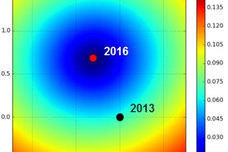
The position of the 2016 DPRK nuclear test relative to that of the nuclear test in 2013. The location of the 2016 event is estimated by comparing data from four CTBTO seismic stations in the region. The axis units are kilometres.
Also, by using satellite-based interferometric synthetic aperture radar (InSAR), a form of radar in which sophisticated processing of radar data is used to produce a very narrow effective beam, the German NDC found areas of ground subsidence and adjacent areas of elevation of several centimetres at the DPRK nuclear test site in a narrow time window around the 6 January event. This is an independent method that can be used to confirm the seismic location of the event. The coordinates reported by the CTBTO are very close to the location indicated by InSAR.
See related BBC article: Sentinel maps North Korean nuclear blast aftermath
See related BBC article: Sentinel maps North Korean nuclear blast aftermath
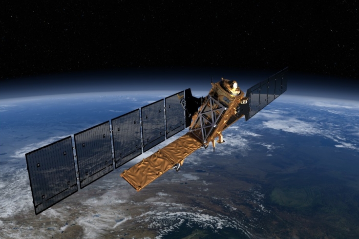
The European Space Agency's Sentinel-1a radar satellite. Copyright: ESA/ATG Medialab
22 Apr 2016