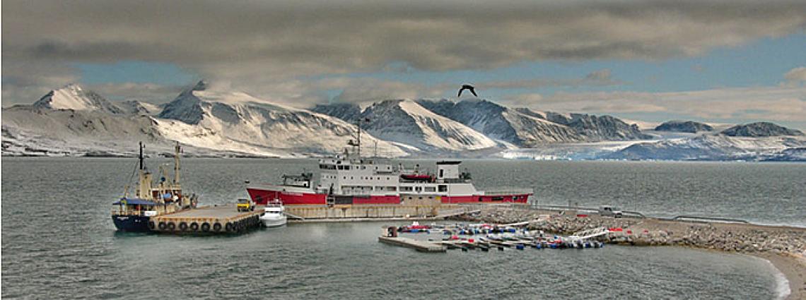
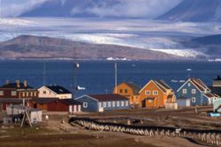
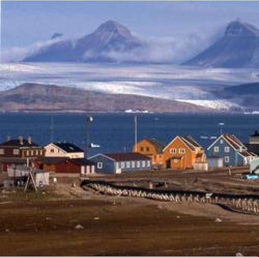
AS72, Spitsbergen, Norway
Thumbnail profile: Spitsbergen
Spitsbergen, the largest island in the Svalbard archipelago situated in the Arctic Ocean, belongs to Norway under the Spitsbergen Treaty of 1920. Covering about 40,000 km², it is 450 km long and between 40 and 225 km wide. The name Spitsbergen means "jagged peaks". It was bestowed on this island by the Dutch explorer Willem Barents, who discovered it while searching for a Northern Sea Route in 1596. Located far above the Arctic Circle, the sun stays visible above the horizon 24 hours a day from the end of April to the end of August. From the end of October until mid-February, it is continuously below the horizon, whilst from mid-November to end January, there is the so-called “civil polar night”, during which time it remains continuously dark and artificial light must be used 24 hours each day. Spitsbergen is also known for the Svalbard Global Seed Vault which is located on the island, which holds duplicate samples, or "spare" copies, of seeds held in genebanks worldwide.

Geography and Geology
The Svalbard Archipelago, which means “Cold Coast”, is located midway between Norway and the North Pole. It consists of four main islands and some 150 smaller ones totalling 62,800 km2, 60% of which is a glacier. The highest elevation is 1,717m and most of the archipelago is mountainous and dotted with large and small glaciers. Spitsbergen’s landscape is characterized by rugged, steep-flanked mountains, with large, glacially eroded fjord systems. The highest peak is Newtontoppen (1,717 m) in the northeast of the island. Geologically, Svalbard has a very long, rich, diverse history that makes it attractive to geologists. A great deal can be learned there about the development of tectonic features and sedimentary environments through time, as well as about the drift of continents across the Earth’s surface. For example, the oldest till (i.e. unsorted glacial sediment) deposits on Svalbard were probably from the time when Spitsbergen was situated close to the South Pole, some 600 million years ago. On the other hand, the red Devonian sandstone of northern Spitsbergen was deposited when Svalbard was close to the Equator, some 350 to 400 million years ago.

AS72, the northernmost station of the IMS network, is exposed to the arctic climate of Spitsbergen...
Climate
The climate of Svalbard is arctic, with mean annual air temperatures of about –6oC at sea level and as low as –15oC in the high mountains. Precipitation, predominantly in the form of snow, measured at sea level is low, only about 200 mm in central Spitsbergen, though somewhat higher along the coast. It is usually dry between April and May while it is comparatively humid between February and March and August and September. December to January may see heavy snowfalls. Meteorologically, this border zone is very active at times with cyclones generating unstable, often stormy weather. There may be very windy periods during winter, and fog is common during the summertime in coastal areas. April and May are often calm and sunny. Large valley glaciers and ice caps are frequent along both the west and east coasts of Spitsbergen. In these more humid coastal regions, glacier velocities frequently are more than 10 to 30 m per year, causing large crevasses to form. Spitsbergen falls within the zone of continuous permafrost. At the coast the perma-frost thickness is 10 to 40 m, but increases to more than 450 m in the highlands. Terrain phenomena such as pingos (i.e. an Inuit word for a mound of earth-covered ice found in the Arctic, subarctic and Antarctica that can reach up to 70 m in height and up to 2 km in diameter), ice wedges and rock glaciers are widespread. Snow avalanches are frequent, especially on downwind slopes.
...a meteorologically very active border zone with cyclones generating unstable, often stormy weather.
Mandate of Auxiliary Seismic Stations
Auxiliary seismic stations are mandated to provide data to the International Data Centre (IDC) upon request only but then with immediate availability. The purpose of this additional data is to improve location accuracy of seismic events detected by the primary seismic network. It is also to characterize the seismic sources with greater precision in order to ascertain what kind of event has taken place; for example, an earthquake or an explosion. Learn more about how the seismic technology works.
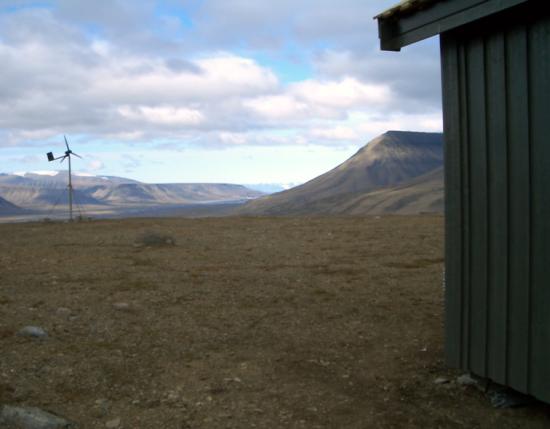
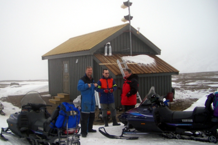
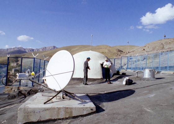
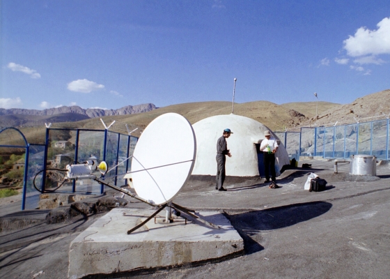
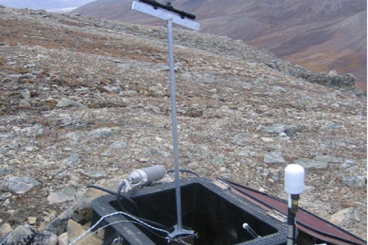
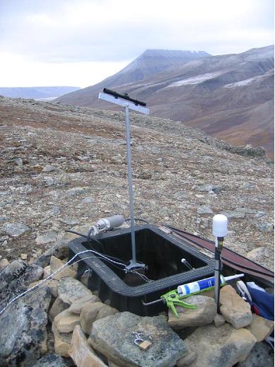
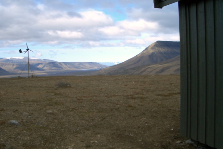
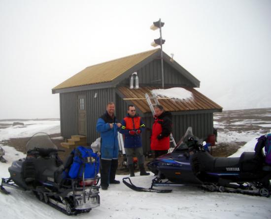
AS72 is very isolated and can sometimes only be reached on foot or by helocopter.
The International Monitoring System (IMS) auxiliary seismic station AS72 is located approximately 18 km from the city of Longyearbyen, the administrative centre of Svalbard. Together with radionuclide station RN49, which is housed at the same location, it is the northernmost monitoring station in the IMS network. Due to the remoteness from any major settlement, the only background seismic ‘noise’ is from waves of the nearby Atlantic Ocean. For the purposes of radionuclide monitoring, the exposure of the site to strong winds that can carry airborne radioactive particles from long distances is ideal.
Station Profile
All seismic stations, including this one at Spitsbergen, have three basic parts: a seismometer to measure the ground motion, a recording system which records the data digitally with an accurate time stamp, and a communication system interface. AS72 is a nine-element seismic array—that is, a spatially distributed set of seismometers all transmitting their outputs to and recorded at a Central Recording Facility — arranged in two concentric circles. The station includes three sites: the nine array elements; one central building at the array; and the data recording centre at Svalbard University Centre in Longyearbyen.
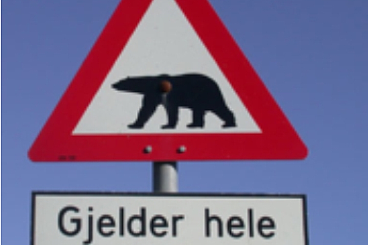
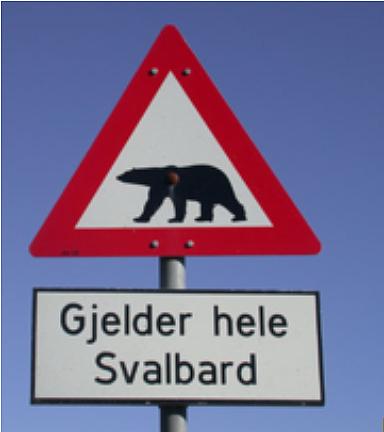
In terms of power supply, AS72 is powered by a state-of-the-art hybrid power system composed of two power generators, a windmill and an “intelligent power management module”. The system is installed in the central building and ensures that all equipment has plentiful, good quality power all year round. The Stirling-brand engine generator has proved itself a good solution for a stand-alone or backup power source for IMS stations in harsh arctic environments, where neither the photovoltaic arrays nor wind-generators are considered reliable. As regards physical security, AS72 station is very isolated. It is 18 km from Longyearbyen and can be accessed only on foot or by helicopter in summer and on foot, skis or snow-mobile in winter. The presence of polar bears is dangerous; all persons are required to carry a rifle and conform to the licensing requirements in effect on the island. The central building is locked and its windows covered by wood. All vaults have locked lids. Although theft is considered unlikely, there are concerns that the Global Positioning System (GPS) antennas might be destroyed by polar bears.
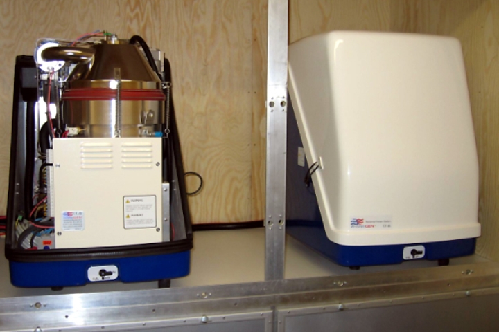
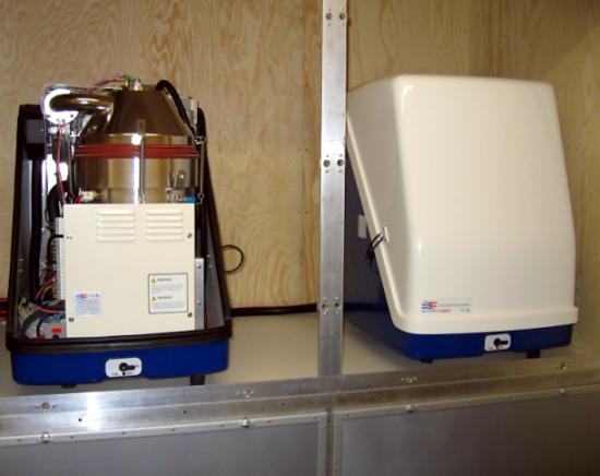
Seismic equipment at AS72.
Testing and Certification
In 1999 the Norwegian Government ratified the CTBT. NORSAR, an independent research foundation specializing in software solutions and research activities within applied geophysics and seismology, was designated the Norwegian National Data Centre (NDC)’s Station Operator to verify compliance with the Treaty. In 2005 and 2006 the AS72 array was upgraded to comply with the IMS minimum requirements for station specifications. At the same time, new seismometers and data authenticating digitizers were installed, together with the new hybrid autonomous power system. After extensive testing, the station was found to meet or exceed the IMS minimum requirements and was certified on 27 April 2007. In addition to the two above-mentioned IMS stations, Norway hosts two primary seismic stations and one infrasound station.