Using IMS data for climate studies
The IMS captures four types of data: seismic, hydroacoustic, infrasound, and radionuclide. The network (interactive map) is about 90 percent complete, with some 300 monitoring facilities installed and operational.
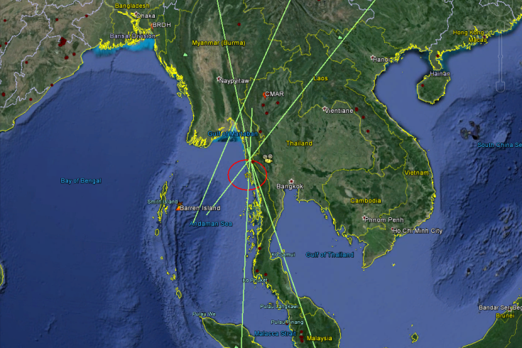
Detection of an airburst, presumably from a meteor, over Thailand on 7 September 2015 by five CTBTO infrasound stations.
In the process of watching, listening and “sniffing” the globe for signs of nuclear explosions, our monitoring network generates large amounts of data that help scientists better understand our planet, and are applied in a wide range of fields, from atmospheric and climate science, to recording earthquakes and tracking marine mammals.
One of the key merits of the CTBTO system is that it has a set of fixed stations which provide a stable monitoring baseline. That stability is useful.
- Identification Signals from Atmospheric Storms
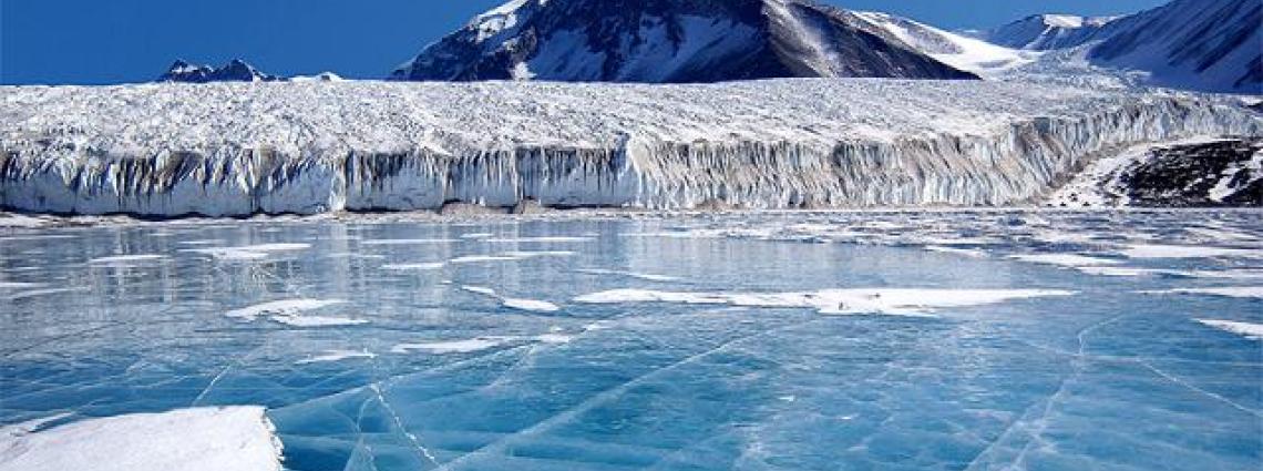
- Tracking Icebergs with Hydro-Acoustic Arrays of the International Monitoring System
- Global Infrasound from Nonlinear Ocean Wave Interactions
- Meteorological Flow Characteristics of Different Regions of Nepal
- Ocean Acoustic Thermometry Using Active Biological Sources Recorded at IMS Hydrophones: A Feasibility Study

Over 1,100 participants at the 2015 CTBT: Science & Technology Conference: scientists, academics, diplomats and media representatives
Overview: Potential uses of IMS data for climate change monitoring
| Infrasound | Radionuclide | Hydroacoustic | Seismic |
|---|---|---|---|
| Signals generated by the calving of icebergs and movements of glaciers | Increase understanding of the long-range exchange of pollutants through tracking the transport of air masses or validating atmospheric transport models | Research on the calving of icebergs and ice shelf break-up as indicators of warming at the ice shelves | Serving as an additional source for studying the melting of glaciers, whose size and movements can affect seismic signals |
| Microbaroms (very low-frequency sound waves generated in marine storms), hurricanes and tornadoes to assess the intensification of storm activity | Monitor the stratosphere/troposphere exchange and validate global climate models by using radionuclides as tracers | Improving weather prediction and estimates via the inference of ocean temperature | Study of the differences in wave travel time (acoustic impedance temporal variations) in the lower atmosphere using co-located seismic and infrasound stations |
| Signals generated by landslides and avalanches as indicators of climate change | Monitor seasonal and yearly variations of specific radionuclides which might be connected to climate variations | Support research on ocean processes and marine life, such as whale populations and migration patterns that might be affected by climate change | |
| Specific sources along a fixed source-to-station path to determine seasonal and yearly variations of some atmospheric properties | Determine the quantity of dust and pollens present over a certain period of time as well as the evolution of chemical contents in dust | Measuring water temperature by means of ‘acoustic thermometry’ |
The CTBTO's own direct contribution
Along with other United Nations and international entities housed in the Vienna International Centre, and globally, the CTBTO seeks to minimise the environmental impact of its everyday operations. Measures adopted include offering a paperless conference document system for Member States' meetings, using renewable sources of energy and reducing travel.
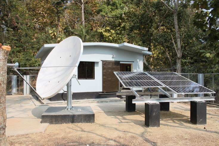
The same care applies to building and operating IMS stations, which are increasingly equipped with solar panels. None of the stations produce emissions or waste, and local stations operators are contracted for routine service and maintenance.
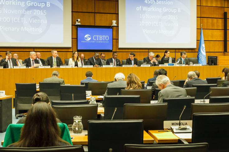
Largely paperless: meetings of the CTBTO PrepCom and its subsidiary bodies.
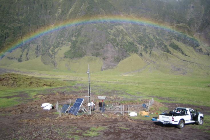
Infrasound station IS49, Tristan da Cunha, South Atlantic Ocean (UK)
Treading softly on Midway Island...
For the construction of radionuclide station RN78 on Midway Island in the Pacific Ocean (United States), an obsolete building was used to house the detection equipment in order to avoid major construction activity. Additionally, the air collecting system was fitted with special silencers and a safety net to minimize noise emissions and avoid injury to birds.
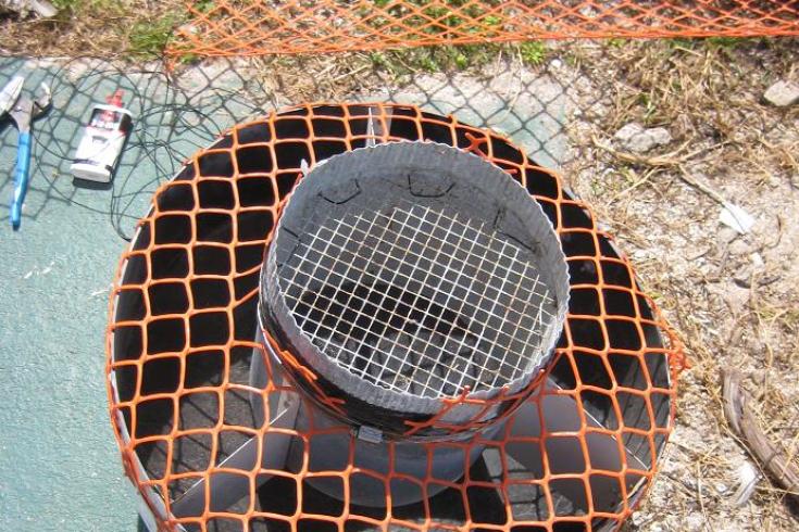
A net was placed on the inlet to prevent birds from entering the system - protection for bird and system alike.
The birds found the inlet of our system very warm and comfortable but this was causing serious problems for air sampling. We found a solution by placing a net to cover the inlet. It helps to protect both the system and the birds.
...in New Zealand...
Another example of the commitment of the CTBTO to sustainable building is the infrasound station IS36 within a protected conservation reserve on New Zealand’s Chatham Island. Special care was taken to prevent any damage to the forest. Wheel barrows replaced heavy machinery during the installation and some pipes of the infrasound arrays were bent around trees.
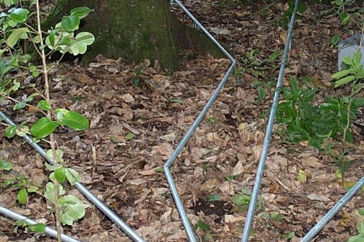
Array element pipes of infrasound station IS36 in New Zealand have been bent around the trees.
...in Patagonia...
Also in the southern hemisphere, at infrasound station IS02 at the southernmost tip of Argentina, the station’s communication setup had to be adjusted to respond to national requirements for environmentally protected areas. Instead of opting for radio communication with a number of radio towers, much less intrusive fibre optic cables were installed.
...and on Kiritimati Island.
But even when monitoring stations are not built in national parks or protected areas, special care is taken consistently to minimize the potential impact on the environment. Many stations are located in isolated areas and need an independent fuel supply to run them. At the radionuclide station RN39 on the Kiritimati Island in the Pacific, special diesel tanks were designed to prevent the possibility of leaks that could contaminate the shallow water table on the island.
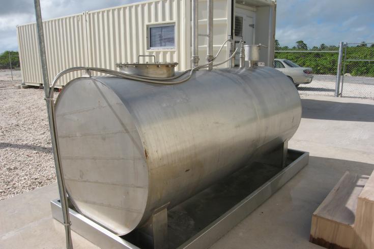
Special precautions are taken during the installation of diesel tanks to prevent contaminating leaks.
27 Nov 2015