IS55, Windless Bight,Antarctica, United States
The name Antarctica comes from the Greek word ?ntarktiké, meaning "opposite of the Arctic".
Thumbnail Profile: Antarctica
The first confirmed sighting of this vast continent took place only in 1820. Even then, due to its hostile environment and lack of infrastructure and resources, Antarctica remained largely isolated and neglected until the 20th century.
Measuring 14.4 million km² in area, the Antarctica is the world’s fifth largest continent.
Geography, Demographics and Resources
Although the geology of Antarctica is difficult to study because the continent is permanently covered with a thick layer of ice, new techniques, such as remote sensing, ground-penetrating radar and satellite imagery, have begun to reveal the structures beneath the ice. These technologies have revealed that West Antarctica geologically resembles the Andes mountain range of South America while East Antarctica is geologically varied, dating from the Precambrian era, with parts formed more than three billion years ago.

There are virtually no permanent human residents nor any evidence of existing or pre-historic indigenous populations.

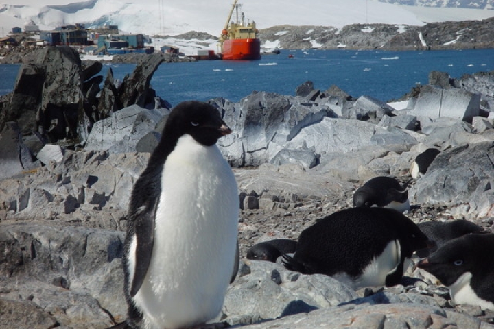
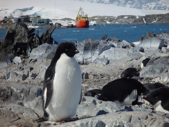
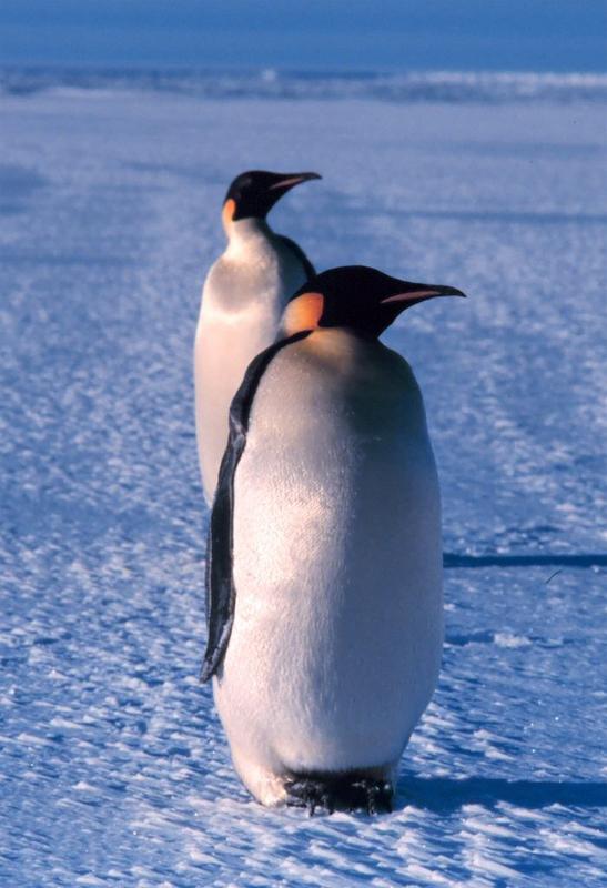
Only the few plants and animals, for example penguins, that are adapted to the cold survive in Antarctica.
Climatic Extremes
Antarctica is by far the coldest place on Earth, with the lowest ever recorded temperature of -89°C. Heavy snowfalls of well over a metre in 48 hours are relatively frequent on the coastal portion of the continent. It is also the windiest continent, with strong katabatic winds off the polar plateau blowing at gale force with gusts of over 250 kmph at the edge of the continent. Antarctica is also the driest continent. The South Pole receives less than ten centimeters of precipitation a year on average and, over the central portion of the continent, ice lasts for extended time periods.
While the South Pole is virtually awash in sunshine 24 hours a day during the summer months, the contrast with winter’s long periods of constant darkness creates unique climatic phenomena unfamiliar to much of the rest of the world such as aurora australis, or “southern lights”, that glow in the night sky near the South Pole.
Antarctica’s Legal System
Antarctica has no "permanent population"; hence, no citizenship, no government, no sovereignty. All persons present on Antarctica are citizens or nationals of some other sovereign state. In fact, parts of Antarctica have been claimed by one or more countries. Governments that are party to the Antarctic Treaty and its Protocol on Environmental Protection (see below) implement these agreements, and decisions taken under them, through national laws that generally apply only to their own citizens.
Establishing the legal framework for the management of this continent without an indigenous population, the Antarctic Treaty was initially signed in 1959 by twelve countries. It holds the distinction of being the first arms control agreement established during the Cold War. As of 2008, 46 countries, including the Russian Federation, the United Kingdom and the United States, had signed what is now called the Antarctic Treaty System, which regulates international relations with respect to Antarctica.
The CTBTO scientists and station operators working in Antarctica are among the most technically proficient in the world.
Science in the Antarctic
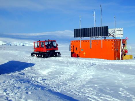
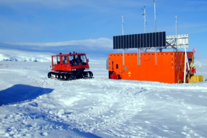
The IS55 infrasound array is located about 26 km northeast of the McMurdo Station on the southern extremity of Ross Island.
The CTBTO in Antarctica
The CTBTO Preparatory Commission also maintains 13 of its International Monitoring System (IMS) stations in Antarctica. They represent three of the four technologies used to monitor the globe for nuclear explosions in locations as follows (Please see map and note that “C” indicates that the station in question has been certified):
Seismic Stations (5) Country
- PS05 Mawson (C) Australia
- AS35 SANAE (C) Germany/South Africa
- PS50 Vanda (C) USA
- AS106 Palmer Station (C) USA
- AS114 South Pole (C) USA
Radionuclide Stations (4) Country
- RN05 Mawson Australia
- RN32 Dumont dÚrville France
- RN69 Halley UK
- RN73 Palmer Station (C) USA
Infrasound Stations (4) Country
- IS03 Davis Base Australia
- IS27 Georg von Neumayer (C) Germany
- IS54 Siple Station USA
- IS55 Windless Bight (C) USA

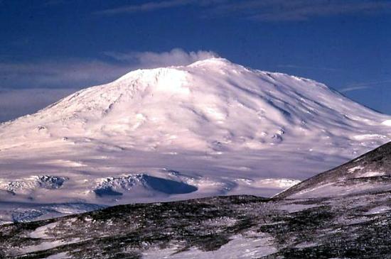
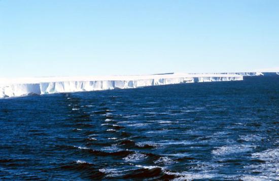
The Ross Ice Shelf was originally named the “Ice Barrier” since this massive block of ice prevented maritime exploration further south into Antarctica.
Clearly, establishing and maintaining them in the face of the daunting climatic and technical challenges described above is a feat in itself. The scientists and station operators working in Antarctica are the most technically proficient in the world. Many of them work on the Ross Ice Shelf, described below.
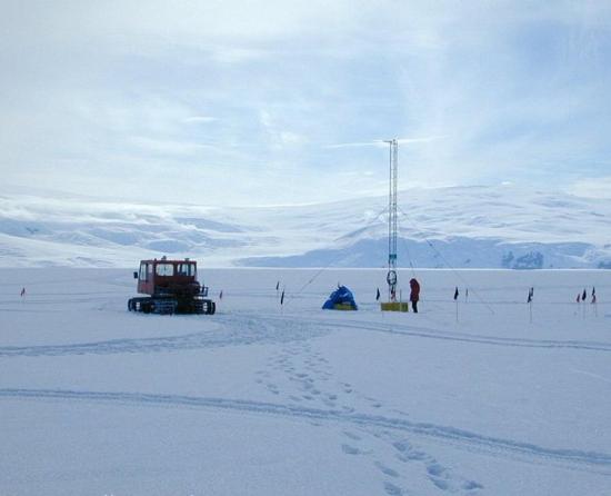
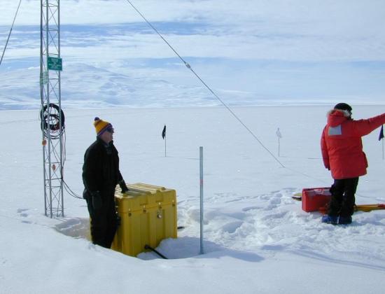
Station Location: IS55 on the Ross Ice Shelf at Windless Bight
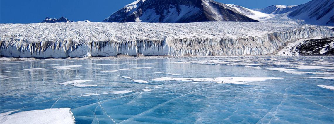
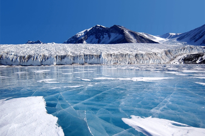
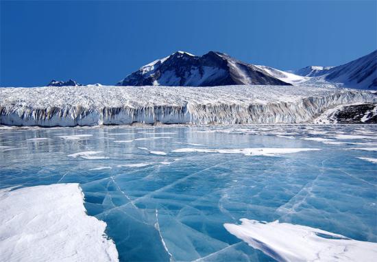
The Ross Ice Shelf, Antarctica’s largest, is several hundred metres thick and covers over 487,000 km². Visible from the open sea, its near vertical ice walls jut out of the water, thrusting upwards to heights ranging from 15 to 50 metres. The Ross Ice Shelf was originally named the “Ice Barrier” since this massive block of ice prevented maritime exploration further south into Antarctica.
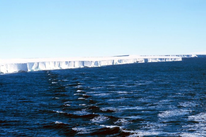
The Ross Ice Shelf, Antarctica’s largest, is several hundred metres thick and covers over 487,000 km².
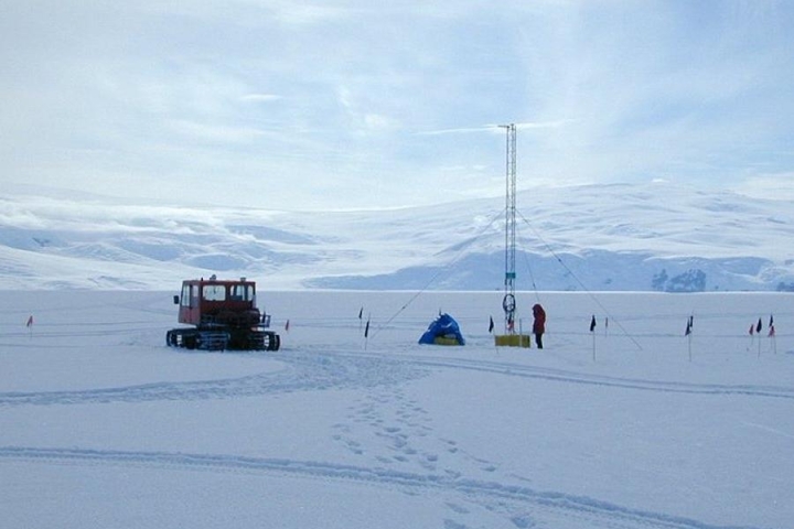
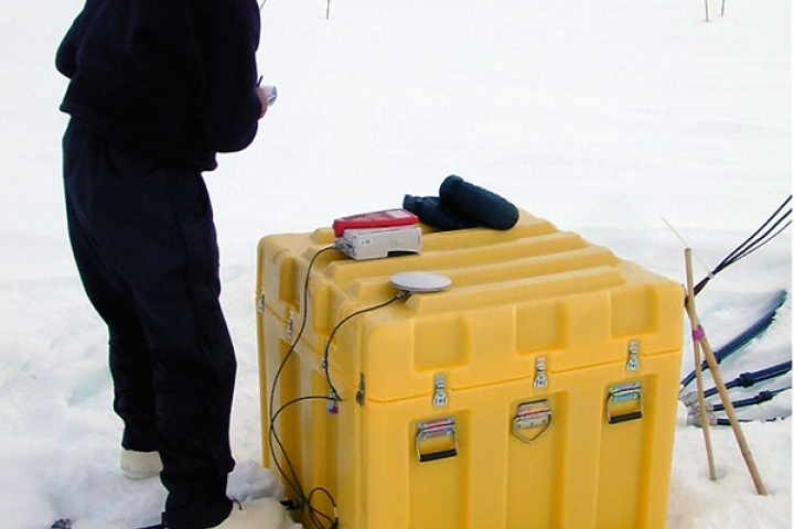
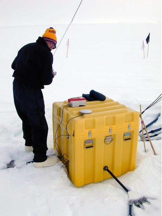
The IS55 infrasonic array is an eight-element array divided into two sub-arrays.
Station Profile
In 1976, the Geophysical Institute of the University of Alaska at Fairbanks, under the sponsorship of the United States’ National Scientific Foundation (NSF), established an infrasonic microphone array on the Ross Ice Shelf near the U.S. stations at McMurdo.
The IS55 infrasonic array is an eight-element array divided into two sub-arrays. A high performance weather station is also installed at one of the IS55 arrays. Temperature, wind speed and wind direction data are sampled once per second and transmitted to the Central Recording Facility (CRF). Data from the array showed that noise levels at Windless Bight were exceptionally low.
Installation of IS55 was completed in 2001.
Testing, Evaluation and Certification
Completed in February 2001, site preparation and equipment installation at IS55 was carried out by the University of Alaska at Fairbanks, under contract to the CTBTO.
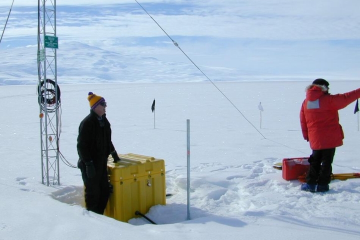
Infrasonic authenticated data from each element, along with the meteorological data, are reformatted at the CRF into 30-second authenticated data frames and transmitted via a satellite link from McMurdo to Brewster, Washington, to Denver, Colorado and then via the Global Communications Infrastructure (GCI) satellite telemetry system to Vienna, Austria.
Consistent with the CTBTO’s certification process, IS55 Windless Bight successfully met all minimum requirements for an IMS infrasound station. Continuous transmission of data from IS55 via the GCI to the International Monitoring System (IMS) Laboratory began in May 2002.

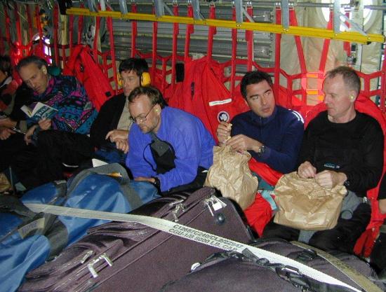
Our team flying in for the certification visit in 2002.